 Ferry network
US ferry routes & schedules — WSF, NYC Ferry & more
United States has 211 ferry routes operated by 16 companies across 113 ferry ports. The average crossing takes about 14m, with the longest running roughly 1h 55m. Major operators include Black Ball Ferry Line, Block Island Ferry, Buena Vista Ferry, Canby Ferry, Cape Lookout National Seashore and Cuttyhunk Ferry Company. Below you'll find crossing times, operators and timetables for each route.
- 211
- Ferry routes
- 16
- Operators
- 113
- Ports
- 14m
- Avg crossing
About
About ferries in United States
Boats that go to work: how ferries actually function in the United States
Forget the Mediterranean postcard. In the United States, the ferry is mostly a piece of infrastructure — a floating extension of the road grid or the transit map. People aren't island-hopping on vacation so much as commuting to a job, hauling groceries home, or getting a pickup truck to a place with no bridge. There is no national ferry company here. Instead you get a patchwork of state agencies, city transit departments, county services, and a handful of private operators, each solving a local problem. You can browse every US ferry route to see how regional these systems really are.
Puget Sound: the biggest fleet in the country
Washington State Ferries is the largest ferry operator in the United States, running passenger and vehicle service across Puget Sound and out to the San Juan Islands 365 days a year. It is genuinely a highway that floats — locals treat a sailing the way the rest of the country treats a freeway on-ramp. The critical thing to know is how vehicles board. On the busiest car routes — Anacortes to the San Juan Islands, the international run up to Sidney, British Columbia, and Port Townsend–Coupeville — you need a vehicle reservation in advance. On the San Juan sailings, most of each boat's car deck can be reserved ahead of time, with a slice held back for standby and emergency vehicles. Foot passengers, by contrast, just show up, buy a walk-on fare at the terminal, and board — no reservation needed. That split is the single most useful rule for a first-timer: drive-on means plan ahead, walk-on means walk on. Reservations are one-way, so remember to book your return leg separately.
New York's free and flat-fare boats
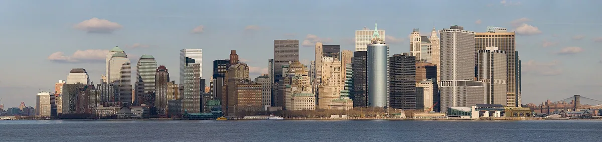
New York City runs its ferries as pure transit, and the headline is hard to beat: the Staten Island Ferry is completely free. Operated by the city's Department of Transportation, it shuttles between Whitehall Terminal at the southern tip of Manhattan and the St. George terminal on Staten Island, a roughly 25-minute crossing, around the clock, every day of the year. It carries something like 22 million people a year and has been fare-free since 1997 — which also makes it the best no-cost view of the Statue of Liberty and Lower Manhattan anywhere. Separately, the city-backed NYC Ferry network links waterfront neighborhoods across the East River and beyond at a single flat fare, priced to compete with a subway swipe rather than a sightseeing cruise. Neither of these carries your car; they move people.
The Alaska Marine Highway: America's grand exception
If any US ferry captures the romance of a long sea voyage, it's the Alaska Marine Highway System, a state-run service that is a designated National Scenic Byway made entirely of water. Sailings begin in Bellingham, Washington and thread north through the Inside Passage toward Ketchikan, Juneau, Sitka, and Skagway. This is not a quick hop — the Bellingham-to-Ketchikan leg alone runs well over a day at sea, and going the full distance to the top of the panhandle takes the better part of three days. Because the trips are so long, the boats are built to sleep in. You can book a private cabin with berths (some with a private bath), settle into a reclining lounge chair, or do what budget travelers and adventurers have done for decades: pitch a small free-standing tent on the covered, heated solarium deck or roll out a sleeping bag under the stars. Onboard you'll find showers and food service, and for many coastal Alaskans this is the only practical link to the outside world.
New England islands: reserve your car early or don't bring it
Off Cape Cod, the Steamship Authority is the lifeline to Martha's Vineyard and Nantucket, sailing from Woods Hole and Hyannis respectively. It's the only service licensed to carry vehicles to the two islands, and in summer that scarcity bites hard. Car space is reservation-only on the Vineyard route, and the booking window for peak-season travel opens in the depths of winter — residents get first crack in late January, with the general public following shortly after, and prime July and August car slots can vanish almost immediately. A standby wait list exists, but the honest advice is simple: if you must bring a car in summer, book the moment reservations open, or go as a foot passenger and rent or bike on the island.
The regional workhorses worth knowing
Beyond the big names, the network is full of dependable local crossings:
- Cape May–Lewes Ferry — a scenic 17-mile, roughly 85-minute vehicle crossing of Delaware Bay linking southern New Jersey and Delaware, a genuine shortcut that skips a long inland drive.
- Casco Bay Lines — Portland, Maine's year-round service to the islands of Casco Bay, carrying passengers, freight, mail, and (to some islands) vehicles; its mailboat run is a beloved slow cruise past the whole archipelago.
- Black Ball Ferry Line (MV Coho) — a US–Canada car-and-passenger link across the Strait of Juan de Fuca between Port Angeles, Washington and Victoria, British Columbia, a roughly 90-minute crossing (remember your passport).
What to expect as a rider
| System type | Typical booking | Cars? |
| State highway (WSF, Alaska) | Vehicle reservations on key routes; walk-ons flexible | Yes |
| City transit (Staten Island, NYC Ferry) | Free or flat fare, no reservation | No |
| Island lifeline (Steamship Authority) | Car space sells out months ahead | Yes |
| Regional crossing (Cape May–Lewes, Coho) | Reserve vehicle in peak season | Yes |
The bottom line: figure out whether the boat is transit, a highway, or a lifeline, and you'll know whether to reserve, when to arrive, and whether your car is coming along. For operator specifics, Washington State Ferries and the Alaska Marine Highway System publish the most detailed schedules and fares.
Operators
Which companies run ferries in United States?
- Black Ball Ferry Line
- Block Island Ferry
- Buena Vista Ferry
- Canby Ferry
- Cape Lookout National Seashore
- Cuttyhunk Ferry Company
- Golden Gate National Recreation Area (Alcatraz Island)
- Guemes Island Ferry
- Gulf Islands National Seashore
- Lummi Island Ferry
- MBTA Ferry
- NY Waterway
- NYC Ferry
- Wahkiakum Ferry
- Washington State Ferries
- Wheatland Ferry
Regions
Ferry regions in United States
Coastal travel is local — jump to a region for its routes, quays and timetables.
Ports
Ferry ports in United States
112 ports with published ferry connections. Open a port for every route that departs or arrives there.
- Pier 11 / Wall St.26
- Logan Airport Ferry Terminal16
- Brookfield Place Terminal15
- East 34th Street14
- Midtown / W. 39th St.14
- Paulus Hook10
- Port Imperial / Weehawken9
- Anacortes8
- Central Wharf (Aquarium)8
- Friday Harbor8
- Greenpoint8
- Hingham (Hewitts Cove)8
- Hoboken / NJ Transit Terminal8
- Hoboken 14th Street8
- Lopez Island8
- North Williamsburg8
- Orcas Island8
- Shaw Island8
- Atlantic Ave/BBP Pier 66
- Dumbo/Fulton Ferry6
- East 90th St6
- Hull (Pemberton Point)6
- Hunters Point South6
- Long Wharf (North) - Gate 5A6
- Seaport (Fan Pier)6
- South Williamsburg6
- Astoria4
- Bay Ridge4
- Brooklyn Navy Yard4
- Corlears Hook4
- Edgewater Ferry Landing4
- Fauntleroy4
- Harkers Island4
- Lincoln Harbor4
- Long Island City4
- Lovejoy Wharf (North Station)4
- Quincy (Squantum Point)4
- Red Hook/Atlantic Basin4
- Roosevelt Island4
- Seattle4
- Soundview4
- Southworth4
- St. George4
- Stuyvesant Cove4
- Sunset Park/BAT4
- Vashon Island4
- Winthrop (Winthrop Landing)4
- Belford / Harbor Way3
- South Amboy3
- Alcatraz Island2
- Anacortes Terminal2
- Bainbridge Island2
- Beaufort2
- Block Island Ferry, New Shoreham, RI2
- Bremerton2
- Buena Vista2
- Canby Ferry - North2
- Canby Ferry - South2
- Cape Lookout2
- Cathlamet, WA2
Show all 112 portsShow fewer
- Charlestown (Navy Yard)2
- Clinton2
- Coupeville2
- Cuttyhunk Ferry Pier, New Bedford, MA2
- Cuttyhunk Island, Cuttyhunk, MA2
- East Boston (Lewis Mall)2
- Edmonds2
- Ferry Point Park2
- Gov. Island/Yankee Pier2
- Guemes Island Terminal2
- Haverstraw2
- Jefferson2
- Kingston2
- Liberty Harbor / Marin Blvd.2
- Long Wharf (LW)2
- Long Wharf (North) - Gate 5B2
- Matheny Road2
- Midtown West 39th St-Pier 792
- Mukilteo2
- Ossining2
- Pier 332
- Point Defiance2
- Point Judith Ferry Terminal, Narragansett, RI2
- Port Angeles (arrive 20 min ahead for customs clearance)2
- Port Liberté2
- Port Townsend2
- Rockaway2
- Rowes Wharf2
- Shackleford Banks East End2
- Shackleford Banks West End2
- Tahlequah2
- Westport, OR2
- Wheatland Road2
- Fort Pickens1
- Gooseberry Point Terminal1
- Lummi Island Terminal1
- Pensacola Beach - Quietwater1
- Fort Jefferson
- Georges Island (GI)
- Governors Island
- Hingham Ferry Terminal (HING)
- Hollis
- Ketchikan
- Key West Ferry Terminal
- Long Wharf (North) - Gate 5C
- Lynn (Blossom Street Pier)
- Oak Bluffs, Martha's Vineyard, MA
- Peddocks Island (PI)
- Pensacola (Downtown)
- Quonset Point Pier, Quonset Point, RI
- Seaport/Commonwealth Pier
- Spectacle Island (SI)
At a glance
Which United States ferry crossings run most often?
The busiest published crossings, ranked by number of listed sailings.
| Route | Crossing | Sailings | Operators |
|---|---|---|---|
| Buena Vista → Jefferson | 1m | 127 / wk | 1 |
| Jefferson → Buena Vista | 1m | 126 / wk | 1 |
| Dumbo/Fulton Ferry → Pier 11 / Wall St. | 4m | 96 / wk | 1 |
| Brookfield Place Terminal → Paulus Hook | 7m | 96 / wk | 1 |
| Paulus Hook → Brookfield Place Terminal | 7m | 93 / wk | 1 |
| Atlantic Ave/BBP Pier 6 → Pier 11 / Wall St. | 4m | 73 / wk | 1 |
| Midtown / W. 39th St. → Port Imperial / Weehawken | 5m | 68 / wk | 1 |
| Brookfield Place Terminal → Hoboken / NJ Transit Terminal | 10m | 68 / wk | 1 |
| Matheny Road → Wheatland Road | 2m | 66 / wk | 1 |
| Hoboken / NJ Transit Terminal → Brookfield Place Terminal | 10m | 66 / wk | 1 |
| Hoboken 14th Street → Midtown / W. 39th St. | 7m | 63 / wk | 1 |
| Lincoln Harbor → Hoboken 14th Street | 5m | 62 / wk | 1 |
Timetables
What ferry routes run in United States?
211 routes across the network.
Showing the 150 busiest of 211 routes.
Browse all 211 United States ferry routes150 routes
FAQ
Frequently asked questions
Is there a single national ferry operator in the United States?
No. The US has no nationwide ferry company. Service is provided by a patchwork of state agencies (like Washington State Ferries and the Alaska Marine Highway), city transit departments (the Staten Island Ferry and NYC Ferry), quasi-public authorities (the Steamship Authority), and private operators. Each system is run locally, so schedules, fares, and booking rules vary by region.
Do I need a reservation for Washington State Ferries?
It depends on whether you're driving on. Vehicle reservations are required on key routes, including Anacortes to the San Juan Islands, the run to Sidney BC, and Port Townsend–Coupeville. On the San Juan route most car space can be booked ahead, with a portion held for standby. Walk-on passengers never need a reservation — just buy a ticket at the terminal and board.
Is the Staten Island Ferry really free?
Yes. The Staten Island Ferry has been completely fare-free since 1997. Operated by New York City's Department of Transportation, it runs 24 hours a day between Whitehall Terminal in Lower Manhattan and St. George on Staten Island, a crossing of about 25 minutes. It also offers a free, unobstructed view of the Statue of Liberty.
How long does the Alaska ferry take from Bellingham?
The Alaska Marine Highway sails north from Bellingham, Washington through the Inside Passage. The leg to Ketchikan alone takes well over a day at sea, and sailing all the way to Skagway at the top of the Alaska panhandle takes close to three days. These are multi-day voyages, not quick hops.
Can you sleep on the Alaska Marine Highway ferry?
Yes, and there are several options. You can reserve a private cabin with berths (some have a private bathroom), sleep in a reclining lounge chair, or camp on deck. Many travelers pitch a small free-standing tent on the covered, heated solarium deck or lay out a sleeping bag. Showers and food service are available onboard.
How far ahead do I need to reserve a car to Martha's Vineyard or Nantucket?
As far ahead as possible. The Steamship Authority opens summer vehicle reservations in winter — island residents book first in late January, with the general public following shortly after. Prime July and August car slots can sell out almost immediately, so book the moment the window opens or plan to travel as a foot passenger.
Do US ferries carry cars?
Many do, but not all. State highway-style systems like Washington State Ferries and the Alaska Marine Highway carry vehicles, as do island services like the Steamship Authority and crossings like the Cape May–Lewes Ferry. City commuter boats — the Staten Island Ferry and NYC Ferry — are passenger-only and do not take cars.
What's the difference between walk-on and drive-on ferry travel?
Walk-on means boarding as a foot passenger without your vehicle, which is usually flexible and rarely requires a reservation. Drive-on means bringing your car aboard, which on busy US routes often requires an advance vehicle reservation and earlier arrival. Walking on is typically cheaper and lets you skip the vehicle line.
Can I take a ferry from the US to Canada?
Yes. The Black Ball Ferry Line's MV Coho carries passengers and vehicles between Port Angeles, Washington and Victoria, British Columbia across the Strait of Juan de Fuca in about 90 minutes. Washington State Ferries also runs a seasonal international route from Anacortes to Sidney, BC. Bring a valid passport for these crossings.
What is the largest ferry system in the United States?
Washington State Ferries is the largest, carrying passengers and vehicles across Puget Sound and to the San Juan Islands every day of the year. It functions as a floating highway for the Seattle region, and locals rely on it for daily commuting, freight, and island access rather than tourism alone.
How much does NYC Ferry cost?
NYC Ferry charges a single flat fare per ride, priced to compete with a subway trip rather than a sightseeing cruise. It's a separate system from the free Staten Island Ferry and connects waterfront neighborhoods along the East River and beyond. It carries passengers only, not vehicles.
How long is the Cape May–Lewes Ferry crossing?
The Cape May–Lewes Ferry crosses Delaware Bay in roughly 85 minutes, covering about 17 miles between southern New Jersey and Delaware. It carries both vehicles and foot passengers and runs frequent daily sailings in peak season, serving as a scenic shortcut that avoids a long inland drive.
What are the best scenic ferry rides in the US?
For a bucket-list voyage, the Alaska Marine Highway through the Inside Passage is unmatched. The Staten Island Ferry offers a free Statue of Liberty view, Washington State Ferries frame the Olympic and Cascade ranges across Puget Sound, and Maine's Casco Bay Lines mailboat run cruises past a chain of working islands.
Do I need to arrive early for a US car ferry?
Yes. Even with a reservation, car ferries ask drivers to arrive well before departure — often 30 minutes to an hour ahead — so vehicles can be staged and loaded in order. Late arrivals can forfeit a reservation to standby traffic. Walk-on passengers generally need less lead time.
Are US ferries mainly for tourists or commuters?
Overwhelmingly for commuters and everyday transport. Unlike Europe's vacation-oriented island ferries, most US services move workers, residents, freight, and mail as part of the local transit or highway network. Tourism is a bonus on scenic routes, but the boats primarily exist to keep communities connected.
Explore
Ferries in other countries
























Reviewed by Serhat Özçelik, Founder & Editor of Ferry Schedule Hub · Last updated October 23, 2026.